Trophy Trout Fishing Opportunities
Vermont’s “Trophy Trout” stocking program provides exciting fishing opportunities for anglers of all ages and skill levels. There are 9 river sections and 36 lakes and ponds across the state that are stocked with these two-year old trout, some of which exceed 18 inches in length. Most rivers are stocked with a mixture of brook, brown, and/or rainbow trout, while ponds receive brook trout and rainbow trout.
Special Regulations
Different regulations apply to trout fishing in all specially designated Trophy Trout waters
- Season: 2nd Saturday in April through October 31 (same as statewide regulations)
- Daily Creel Limit: two trout per angler per day
- Minimum Length Limit: None
Stocking Schedule
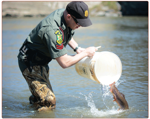
Trophy Trout waters are stocked from late April through the end of May. Rivers generally receive two plantings of fish spaced several weeks apart. To see the proposed stocking schedule and locations, visit our Fish Stocking Plan page. As locations are stocked across the state, the actual stocking dates and numbers are updated on our Fish Stocking Search page.
Deerfield River Trophy Brook Trout Stocking
East Creek Trophy Rainbow Trout Stocking
How To Find Trophy Trout Waters
Trophy Trout waters are distributed across the state. The two interactive maps below will help you find and navigate to any of the 9 rivers and 36 ponds that are stocked with trophy brook, brown, or rainbow trout. Only certain sections of the designated rivers are stocked with Trophy Trout and are under Special Regulations, so be sure to familiarize yourself with the river reaches.
Trophy Trout Streams
Designated Trophy Trout River Sections
Black River: along Rt. 131 in Weathersfield and Cavendish, from Downers covered bridge upstream, approximately four miles, to the next bridge across the river, the Howard Hill Bridge.
Deerfield River: in Searsburg - from the downstream edge of the East Branch Trailhead Bridge upstream 4 miles to the downstream edge of the bridge on Somerset Road near junction with Forest Road 71
East Creek: in Rutland City – from the confluence with Otter Creek upstream, approximately 2.7 miles, to the top of the Patch Dam in Rutland City.
Lamoille River: from the downstream edge of the bridge on Route 104 in the Village of Fairfax upstream, approximately 1.6 miles, to the top of the Fairfax Falls Dam in Fairfax.
Otter Creek: in Danby and Mt. Tabor - From the Vermont Railway Bridge north of the fishing access upstream, approximately 2 miles, to the Danby-Mt. Tabor Forest Rd. Bridge (Forest Road # 10).
Missisquoi River: in Enosburg and Sheldon, from the downstream edge of Kane Road (TH-3) bridge upstream, approximately 5.7 miles, to the top of the Enosburg Falls Dam in Enosburg Falls.
Passumpsic River: in St. Johnsbury, from the top of the Gage Dam upstream to the top of the Arnold Falls Dam. This section includes the Moose River from its confluence with the Passumpsic River upstream to the Concord Avenue bridge.
Walloomsac River: from the Vermont/New York border in Bennington upstream to the top of the former Vermont Tissue Plant Dam (downstream of Murphy Road) in Bennington.
Winooski River: in Duxbury and Waterbury, from the top of Bolton Dam upstream to the Route 2 Bridge east of Waterbury Village. This section includes the Little River: from its confluence with the Winooski River upstream to the Route 2 bridge.

