Vermont Fish & Wildlife Department's Community Wildlife Program is pleased to offer recordings of past webinar topics for interested Vermonters, land-use planners, natural resources professionals, and ecological consultants.
- Go to Fall 2024 Webinars
- Go to Spring 2024 Webinars
- Go to Fall 2023 Webinars
- Go to Spring 2023 Webinars
- Go to Fall 2022 Webinars
- Go to Spring 2022 Webinars
- Go to Fall 2021 Webinars
- Go to Spring 2021 Webinars
- Go to Fall 2020 Webinars
- Go to Spring 2020 Webinars
Fall 2024 Webinars
 Understanding Vermont Conservation Design: The data behind BioFinder
Vermont Conservation Design is the data and the vision that powers the BioFinder website. It is a prioritization tool that identifies the lands and waters most important for maintaining Vermont's ecologically functional landscape – one that conserves current biological diversity and allows species to move and shift in response to climate and land-use changes. Vermont Conservation Design allows users to see patterns in Vermont’s forests and waterways, and identify the places that connect both into a functional network. The Design was just updated with new landscape scale components and Wildlife Road Crossings. It now features more accurate edges of the habitat blocks, that allow for a better understanding of the pattern and network of connected forests. Join us to learn more about this important conservation science.
 Sharing Like Cats and Dogs: Bobcats & Coyotes on the Vermont Landscape
Bobcats and coyotes compete for resources across Vermont. Yet they go about it with very different styles and have settled into an equilibrium since coyotes first appeared in our state in the mid 20th century. Bobcats tend to be more elusive, while their canine counterparts are much more public. Together, these mid-sized mammals occupy a niche in Vermont's ecology that teaches us about the need for an inter-connected landscape. Join Furbearer Project Leader Bree Furfey for an exciting deep dive into the biology, ecology and landscape needs of these two iconic species. We'll also discuss land-use planning strategies that your town can use to ensure their continued presence throughout Vermont.
 Gray and Green Infrastructure: How Vermont's bridges and culverts add to our network of connected lands and waters.
Roads can act as barriers to wildlife movement, and yet our bridges and stream culverts are potential passage for Vermont's fish and wildlife to move underneath without danger. In addition to giving fish and other aquatic species plenty of space to swim through, many of these structures are designed to accommodate large floods and move debris during extreme rainfall. This means that at normal flow levels, wildlife can walk through the structure alongside the stream. However, some of our older structures are undersized and present a constriction for floodwaters as well as for fish and wildlife movement. A team of researchers has created the Terrestrial Passage Screen Tool that is now available on BioFinder to assess the "passability" of bridges and culverts on the state road system and help in prioritizing which structures might be best replaced to facilitate wildlife movement. Join Conservation Planner Jens Hilke from Vermont Fish & Wildlife to learn the science behind this new tool and learn how it may be used to help prioritize structures for replacement to facilitate wildlife movement.
 Reconnecting the Greens Mountains: A multi-pronged approach for enabling wildlife movement
The spine of the Green Mountains is a chain of several huge forest blocks that is the backbone of the Vermont landscape. With relatively few road crossings, wildlife can move among these forests for great distances. This is important for keeping populations healthy and allowing them to adapt to climate change. Yet the Winooski river valley with Interstate 89, Route 2 and the railroad is a significant barrier separating the northern and central Green Mountains. Efforts are underway to ensure that habitat remains connected across these barriers. Join Conservation Planner Jens Hilke and VTrans Biologist Jesse Johnson to learn about the exciting wildlife connectivity projects emerging along the busiest stretch of road in Vermont. Oversized culverts, wildlife shelves, and a state-of-the-art highway underpass are all on the menu as conservation planners find creative solutions to reconnect the Green Mountains for wildlife between Mount Mansfield and Camel's Hump.
SPRING 2024 WEBINARS
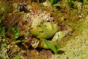 An Introduction to Vermont’s Rare, Threatened, and Endangered Plants
Did you know that the Vermont Natural Heritage Inventory maps and monitors about 600 rare and uncommon plant species across the state? Join State Botanist Grace Glynn for a fun glimpse into some of our rare plants, where they’re found on the landscape, and the ongoing work to conserve them. Learn more about what towns can do to better protect these important pieces of our state’s natural heritage.
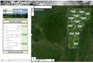 Using BioFinder 4.0: A step by step introduction to using this updated webmap
The BioFinder website is an online map and database that allows users to explore the patterns of habitat distribution that most impact Vermont’s biodiversity. It hosts the Vermont Conservation Design data – all components of a complete vision for maintaining ecological function to secure our natural heritage for future generations. The Biofinder website was just updated to BioFinder 4.0 and while the functionality is nearly identical to the previous version, now is the perfect time to learn how to better use this multi-faceted tool. Join us and improve your skills in using BioFinder. This webinar will focus on the functionality of the webmap itself. To learn more about the data behind the maps displayed on BioFinder, be sure to join an upcoming "Understanding Vermont Conservation Design" webinar.
 Understanding Vermont Conservation Design: The data behind BioFinder
Vermont Conservation Design is the data and the vision that powers the BioFinder website. It is a prioritization tool that identifies the lands and waters most important for maintaining Vermont's ecologically functional landscape – one that conserves current biological diversity and allows species to move and shift in response to climate and land-use changes. Vermont Conservation Design allows users to see patterns in Vermont’s forests and waterways, and identify the places that connect both into a functional network. The Design was just updated with new landscape scale components and Wildlife Road Crossings. It now features more accurate edges of the habitat blocks, that allow for a better understanding of the pattern and network of connected forests. Join us to learn more about this important conservation science.
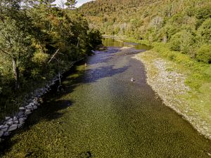 Resilient Rivers: Good for fish and people
Fish and other aquatic organisms face threats from development as well as increasing frequency and intensity of floods and droughts and rising temperatures. Restoring rivers to natural conditions will help ensure the long-term survival of aquatic organisms, and has co-benefits for water quality and flood resilience. This talk will highlight three areas where municipalities can help protect aquatic habitats: forested riparian areas, aquatic organism passage, and log jams. Join VFWD Aquatic Habitat Biologist Will Eldridge to learn how allowing rivers to function naturally where it is safe to do so is more effective and more sustainable in the long run.
FALL 2023 WEBINARS
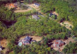 Better Zoning to Prevent Forest Fragmentation
Vermont’s increasing demand for housing and love of our forests is an opportunity to rethink the relationship between development and conservation. Providing housing for those who need it most while maintaining a connected, intact, and diverse ecosystem requires strategic land use planning at the town and regional level. Zoning can steer development into downtown, village, and growth centers and prevent forest fragmentation in rural areas. Towns that have redrawn their zoning lines and adapted development standards have successfully conserved large forest blocks and maintained wildlife connectivity across boundaries. Regional Planning Commissions offer technical assistance and funding opportunities to all member municipalities interested in protecting their valued natural resources. The VT Fish & Wildlife’s Community Wildlife Program has partnered with the Chittenden County Regional Planning Commission’s Senior Planner, Darren Schibler, for a deeper understanding of zoning in our state’s fastest growing county.
 Bats & Land Use Planning
Six of Vermont's nine bat species are now listed as threatened or endangered. Increasing development pressure, climate change, and diseases such as White-nose syndrome call for close species monitoring, education, and statewide outreach. Bat habitat and roost sites such as caves, forests, and houses must be considered when planning land use year-round. Last year’s discovery that an unusually large Indiana Bat colony was still using conserved land in Hinesburg gives hope for the resiliency of this species in the Northeast and highlights Vermont’s unique role in conserving bats within and outside our state boundaries. Join the VT Fish & Wildlife Small Mammal Biologist, Alyssa Bennett, and the Community Wildlife Program to learn about the unique ecological role that bats play and what towns are doing to protect these threatened and endangered species.
 Resilient Right of Ways
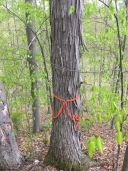
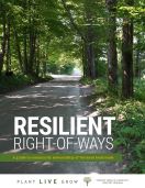
Some of Vermont’s most visible community trees and forests are those within the 27,000 acres of municipal right-of-way vegetation lining our scenic backroads. Beyond their often pleasing aesthetics, these plants, trees, and forests play an essential role in storm water management, invasive species monitoring, forest connectivity, and wildlife movement. To better inform the management of roadside vegetation, the Vermont Urban & Community Forestry Program conducted a roadside assessment along 200 miles of rural roads in 10 case study municipalities. In 2020, the findings of this project were published in, “Resilient Right-of-Ways: A guide to community stewardship of Vermont backroads”, providing town planners, tree boards, conservation commissions and highway crews with best management practices to maximize the ecological and economic benefits of their roadside vegetation. The VT Fish & Wildlife Department Community Wildlife Program is excited to partner with Joanne Garton of the VT Department of Forests, Parks and Recreation and VT Urban & Community Forestry for a deeper look at the opportunities and challenges of roadside tree and forest stewardship.
 Becoming an Environmental Leader in your Town
In order to make real change in your town it is not enough to just understand the science behind land use planning. Real and substantial change occurs when community members rise as leaders and set visionary goals in order to adapt for a changing future. Leaders are people who guide communities to complete tasks that no one individual could have achieved alone. Join the Community Wildlife Program and (partner) to explore what it means to be an environmental leader in your town. We will dive into a variety of leadership styles, phases of group development, and ways to effectively collaborate with diverse groups of stakeholders. In the words of the Chinese philosopher Lao Tzu, "When the best leader's work is done the people say, We did it ourselves."
Spring 2023 Webinars
 How Towns Can Manage Conflicts with Beavers
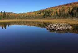
Join the Vermont Fish and Wildlife Community Wildlife Program and wildlife specialist, Tyler Brown, to learn how your town can manage conflicts with beavers. In order to coexist with our state's thriving beaver population we need to become familiar with their natural history, biology, and habitat requirements. Beavers are a keystone species and their wetlands offer many benefits to people and wildlife. Their dam building activities can also create conflicts with private landowners as well as entire towns. There are many strategies to manage beaver activity such as baffles and fencing. Learn how Vermont communities can use town policies to balance the benefits of beaver activity while reducing potential damages to infrastructure. Come explore the world of beavers with us!
Watch the Video Recording
 Becoming an Environmental Leader in your Town
In order to make real change in your town it is not enough to just understand the science behind land use planning. Real and substantial change occurs when community members rise as leaders and set visionary goals in order to adapt for a changing future. Leaders are people who guide communities to complete tasks that no one individual could have achieved alone. Join the Community Wildlife Program and (partner) to explore what it means to be an environmental leader in your town. We will dive into a variety of leadership styles, phases of group development, and ways to effectively collaborate with diverse groups of stakeholders. In the words of the Chinese philosopher Lao Tzu, "When the best leader's work is done the people say, We did it ourselves."
Watch the Video Recording
 Demystifying Subdivision Regulations: Reducing Sprawl Development and Forest Fragmentation
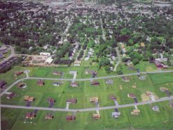
Maintaining an intact network of forests and connecting lands is hugely important for current biological diversity and climate resilience. Subdivision can help towns guide the pattern of development in a community and are an important tool in reducing forest fragmentation and impacts on other natural resources. Subdivision can establish standards for evaluating the impact of land subdivision on natural resources. Within the Mount Ascutney Regional Commission, the vast majority of towns have subdivision regulations that address forest fragmentation. Join us for this deep-dive into an important land use planning tool.
Watch the Video Recording
 Better Habitat Blocks for Understanding Forest Integrity
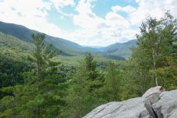
Understanding forest pattern in your town is an important first step in conservation and land use planning. That basic pattern has a lot to do with biological diversity and climate resilience. The habitat blocks dataset is the best way to understand that pattern across Vermont. The Habitat Blocks dataset, first created in 2011, is appropriate for understanding the location of our forests, but the 30m resolution doesn't show all of the connecting lands on the edge of the blocks that facilitate wildlife movement. Recently released high resolution land cover data has allowed the Vermont Fish & Wildlife Department and its partners to re-map the Habitat blocks with greater accuracy around the edges of the blocks. The new data will be released in fall 2023 and will allow your community to better understand the overall forest pattern and connecting lands in your town related to Act 171 the Forest Integrity law. Join us for a special sneak peek at this new and exciting work.
Watch the Video Recording
Fall 2022 Webinars
 Land Use Planning for Climate Change
Vermont’s Climate Action Plan calls for an all hands approach and identifies a wide range of actions that municipalities can lead on, especially with respect to our pattern of land use and how that affects both mitigation and adaptation. It can be overwhelming to understand where to begin and what tools might be most helpful. In this session, participants will learn about a range of land use planning tools that can be used to address climate change and some examples of how they’ve been employed.
Watch the Video Recording
 Using Vermont Conservation Design to Help Plan Your Town's Climate Future
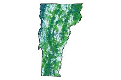
Vermont Conservation Design was first released in 2016 and has been used by towns across the state to identify landscape patterns of connected forests and waters as well as community and species hotspots. Vermont Conservation Design certainly does show these areas of current biological diversity but also speaks to climate resilience into the future. Join Community Wildlife Program staff to learn how these concepts come together and how you can use Vermont Conservation Design on the BioFinder website to better plan for your town’s climate future.
Watch the Video Recording
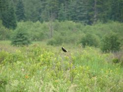 Alive in the Fields: Understanding Grassland Bird Habitat and Protection
Did you know that Vermont is home to eleven species of grassland birds? Did you know that five of these are listed as Threatened or Endangered and the other six are listed as Species of Greatest Conservation Need (SGCN)? That means that many towns across the state need to understand more about these species and their habitats and how to plan land use in a way that works for these species. Join Fish & Wildlife Department Bird Project Leader Doug Morin to learn more about this important topic and what towns can do to protect this piece of natural heritage.
Watch the Video Recording
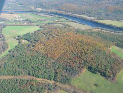 Knowing Your Options:Choosing the Right Tools for Your Town.
Are you interested in protecting your town's natural resources? Do you have conservation goals in mind and are ready to take action? Maybe you are new to municipal planning and looking for ways to get involved?. Whether you are a town planner, landowner, or renter you can help define conservation planning options. There are many examples of successful regulatory and nonregulatory approaches to land use planning across the state. Choosing the right tools at the right time is essential to meeting your conservation goals and balancing the needs of your town. Join the Vermont Fish and Wildlife's Community Wildlife Program staff and see how you can protect your community's ecology and economy in a changing world.
Watch the Video Recording
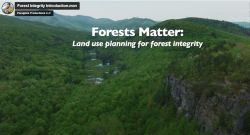 Forests Matter: Land Use Planning for Forest Integrity
The concept of maintaining intact forest in Vermont is not new and is something that town planning and conservation commissions have been implementing for years. But as rural sprawl has increased forest fragmentation and the VT Legislature passed Vermont's Forest Integrity law (often referred to as Act 171), the topic is receiving increased interest. The Department of Forests, Parks, & Recreation and the Fish & Wildlife Department has worked with partners to put together a video series highlighting this important topic. The video series pulls together interviews from a diversity of professionals in the field; from foresters, biologists to planners and volunteers working at the local level. Please join us for this exciting session.
Watch the Video Recording
Spring 2022 Webinars
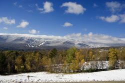 Climate action-planning: What should towns do to address climate change?
Vermont’s first Climate Action Plan has been released and we have lots to do! But where to begin? And what are appropriate climate-related projects for Vermont’s Conservation Commissions and towns to tackle? Join the Agency of Natural Resources’ Global Warming Solutions Act Coordinator, Marian Wolz, and Vermont Fish & Wildlife Department’s Community Wildlife Program staff to learn more about what is in the Climate Action Plan and what your town can do to address these pressing issues.
Watch the Video Recording
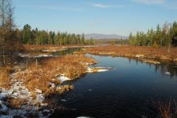 Reviewing your Town Plan & Regulations: Lessons Learned from our Comprehensive Review
Every eight years, Vermont municipalities update their town plans to set the vision for moving forward and balancing an array of competing values. Natural resource issues are an important consideration in this balancing act. While every town is unique and different resources are present in each community, a lot can be learned from what other towns have done to address these topics. The Vermont Fish & Wildlife Department & Vermont Natural Resources Council have completed our decennial review of every town plan, zoning, subdivision & ordinance in Vermont. Our analysis offers insights into best practices in handling natural resource issues in municipal planning. Join this session to learn more about improving your town plan natural resources chapter.
Watch the Video Recording
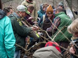 Reinvigorating your Conservation Commission
There are a broad range of activities that Conservation Commissions can engage in, from stewarding town owned land to advising on land use planning to developing educational programs and volunteer opportunities. With all these options, it can be overwhelming and it requires careful planning to help a Conservation Commission move forward. Sometimes commissions need to take a fresh look at what they're doing and make small adjustments to get the group on the same page or get more people involved. Last year the Association of Vermont Conservation Commissions partnered with the Vermont Fish & Wildlife Department to produce a new version of the Conservation Commission Handbook as a reference for commissions to use. This webinar will provide ideas for reinvigorating your commission including outreach, strategic planning and the basics that make Conservation Commission an awesome volunteer opportunity.
Watch the Video Recording
Fall 2021 Webinars
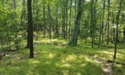 Act 171: Selecting Forest Blocks & Habitat Connectors for Your Town Plan
Act 171 requires towns to identify and protect forest blocks and habitat connectors. But what exactly does that mean? And how do you figure out which blocks and connectors are most valuable to wildlife and your community? Join the Community Wildlife Program at Vermont Fish & Wildlife Department to learn a step-by-step selection process. We'll explain the background science and help towns select areas to prioritize that meet Act 171 requirements and make sense for their community.
Watch the Video Recording
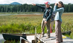 Reviewing Your Town Plan and Regulations: Lessons Learned from Our Comprehensive Review
Every eight years, Vermont municipalities update their town plans to set the vision for moving forward and balancing an array of competing values. Natural resource issues are an important consideration in this balancing act. While every town is unique and different resources are present in each community, a lot can be learned from what other towns have done to address these topics. The Vermont Fish & Wildlife Department & Vermont Natural Resources Council have just completed our decennial review of every town plan, zoning, subdivision & ordinance in Vermont. Our analysis offers insights into best practices in handling natural resource issues in municipal planning. Join this session to learn more about improving your town plan natural resources chapter.
Watch the Video Recording
Spring 2021 Webinars
This webinar series focused on building the capacity of town government to organize, prioritize, and achieve conservation success. Participants learned how to form an effective Conservation Commission, how to inventory their town's ecological features, and how to fund conservation projects.
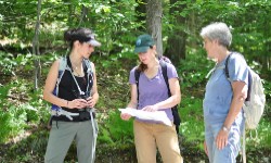 Starting a Conservation Commission
A Conservation Commission is part of municipal government that has a wide purview to engage in all manner of inventory and education related to natural and cultural resources. More than half of Vermont towns already have a Conservation Commission and the activities that Conservation Commissions are engaged in range from land management of town owned forests to land use planning and even development review. Each commission looks a little different and can be incredibly helpful asset to your town.
Watch the Video Recording
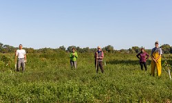 Starting Your Town Conservation Fund
Did you know that towns can establish dedicated funds to pay for conservation? Join Vermont Fish and Wildlife Department's Community Wildlife Program to learn about what it takes to start a Conservation Fund, where the money comes from, and what to do with yours. We'll share useful tips, inspiring project stories from other towns, and help launch you towards realizing your town's conservation aspirations. This webinar is intended for Vermonters serving on town boards and municipal staff, and is hosted in partnership with the Vermont Association of Conservation Commissions (AVCC).
Watch the Video Recording
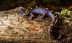 Natural Resources Inventories
For towns, organizations, and landowners looking to better understand their land, conducting a Natural Resources Inventory is a great place to start. Whether you are interested in wildlife, wetlands, or forest blocks, a natural resources inventory can help you identify what matters most and where it occurs on the landscape. Join Vermont Fish and Wildlife Department's Community Wildlife Program to learn how you can effectively kickstart this process and get the most out of your time and resources. This webinar is intended for Vermonters serving on town boards, municipal staff, conservation organizations, and interested Vermonters, and is hosted in partnership with the Vermont Association of Conservation Commissions (AVCC).
Watch the Video Recording
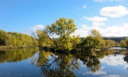 The River Corridor, Floodplains, and Riparian Habitat
The network of streams and rivers across Vermont is critically important for climate resilience. These places are dynamic systems, constantly changing and home to incredible biological diversity as well as many other functions and values. In this collaborative presentation, join a panel of planners from the Agency of Natural Resources to learn about these unique ecosystems at several scales: as part of a larger watershed and network of connected lands and waters, as a unit for town planning, and as dynamic places for river processes.
Watch the Video Recording
Fall 2020 Webinars
This webinar series focused on two themes: 1) Land-use planning for forest integrity and wildlife connectivity; and, 2) Wildlife habitat management at multiple scales. Participants explored maps and data, learned about useful applications and case studies, and left with a better understanding of how their community and land fits into regional efforts to protect Vermont’s native species.
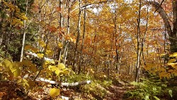 Updating Your Town Plan for Forest Integrity (Act 171)
Since January 1, 2018, towns and Regional Planning Commissions are required to identify forest blocks and habitat connectors, as well as plan for development in those places in ways that minimize forest fragmentation. This requirement asks towns to look at the larger patterns of forests and dive into the science of what is known about connectivity in their region at multiple scales. Some of the data involved is immediately actionable, but some of the models warrant caution and additional research. Tune in to hear how Vermont Fish & Wildlife Department can help your town interpret available data and translate it into actionable planning and policy.
Watch the Video Recording
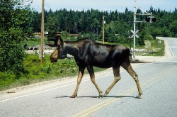 Wildlife Road Crossings
IIn this webinar, join Vermont Fish & Wildlife Department biologists as they explore the science and planning of wildlife road crossings. Learn about the field science of road ecology and what years of camera trapping along roads, bridges and culverts has taught us. Explore the computer models in Vermont Conservation Design to understand wildlife road crossings in a landscape context. Find out how Vermont towns are improving and planning for wildlife movement across local roads.
Watch the Video Recording
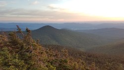 Seeing Beyond Boundaries: Understanding Your Land At Different Scales
Join Vermont Fish & Wildlife Department biologists to see your land at different scales. Begin on the ground, hearing from landowners about their stories from the land. Zoom out to gain a different perspective using BioFinder to see the ecological context in which your land sits. Learn how understanding land at different scales can provide insights into how you manage your land.
Watch the Video Recording
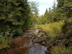 Woods, Waters & Wildlife: Putting the Pieces Together
Join Vermont Fish & Wildlife Department biologists to explore the community- and species-scale natural heritage components that might occur on your land. Learn about different kinds of woods, waters, and wildlife, and how you can use BioFinder to understand how these pieces of the landscape fit together. Hear stories about landowners and get inspired to manage your land in an ecological way!
Watch the Video Recording
 Enhancing Your Backyard, Back Forty, and Beyond
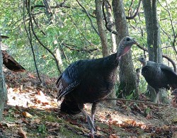
Join Vermont Fish & Wildlife Department biologists to learn tips and tricks for enhancing wildlife habitat on properties of all sizes, from large parcels to small backyards. If you are interested in learning about creating pollinator habitat, making your land a better home for wildlife, and being a part of conserving Vermont species — this is the webinar for you!
Watch the Video Recording
Spring 2020 Webinars
This webinar series focused on the BioFinder mapping tool and the underlying science of Vermont Conservation Design, a statewide effort to identify the most ecologically important lands and waters of Vermont. Participants explored maps and data, learned about useful applications and case studies, and left with a better understanding of how their land fits into regional efforts to protect Vermont’s species from a changing climate, forest fragmentation, and habitat loss.
Intro to Biofinder 3.0: The Go-To Resource for Exploring Vermont’s Biodiversity
Have you ever wondered how your backyard or woodlot fits into the bigger picture? Are you interested in learning about your town’s wildlife habitat and its most important ecological areas? Join Vermont Fish & Wildlife Department's Conservation Planners to learn about BioFinder, a free online portal, mapping tool, and go-to resource for exploring Vermont’s biodiversity. You'll learn what's new with the recently released version of BioFinder 3.0.
Watch the Video Recording
 Using BioFinder 3.0 for Land-Use Planning
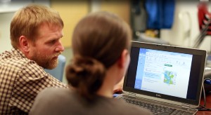
Join Vermont Fish & Wildlife Department's Conservation Planners to learn about BioFinder 3.0, a free online portal showing the state’s most important ecological areas and biodiversity data. We’ll explore how BioFinder can help planners access important ecological data, identify significant forest blocks and habitat connectors, and comply with Act 171. This workshop is intended for members of conservation commissions, planning commissions, development review boards, as well as professional planners and interested citizens. Join us as we work towards planning a vibrant, ecologically healthy future in Vermont.
Watch the Video Recording
 Vermont Conservation Design for Ecological Consultants
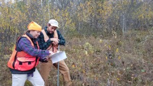
Join in to hear a panel of Agency scientists and regulators discussing Vermont Conservation Design (VCD), a statewide prioritization of the most ecologically important lands and waters in Vermont. VCD offers a practical vision for maintaining ecological function in Vermont, capturing both current biological diversity as well as those resilient landscapes most important for maintaining biological diversity into the future. We'll show you how to access VCD data through the BioFinder mapping portal, a useful tool for remotely reviewing project sites and understanding the ecological context in which they occur. We’ll also discuss how VCD data and maps can bring value to your projects and clients and how the Agency of Natural Resources is using VCD in its regulatory review.
Watch the Video Recording
