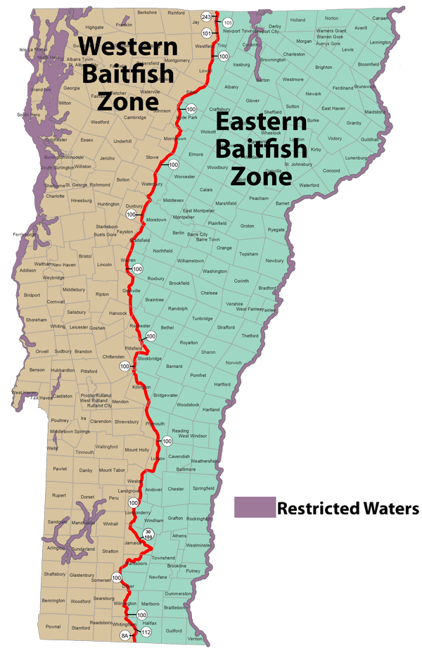
The baitfish regulation establishes a Baitfish Zone Dividing Line which divides the state into the eastern and western baitfish zones.
Baitfish Zone Dividing Line
A line extending from the Massachusetts border following Route 8A north to Route 112, north on Route 112 to Route 100 in Whitingham, north on Route 100 to East Jamaica, northwest on Route 30/100 to Rawsonville, north on Route 100 to Ludlow, north on Route 103/100 to Grahamville, north on Route 100 to Route 4/100, west on Route 4/100 to Killington, north on Route 100 to Morrisville, west on Route 15/100 to Hyde Park, north on Route 100 to Troy, north on Route 101 to Route 105, north on Route 105 to Route 243 in North Troy, north on Route 243 to the Canadian border.
Eastern Baitfish Zone
The baitfish zone including waters lying east of the Baitfish Zone Dividing Line.
Western Baitfish Zone
The baitfish zone including waters lying west of the Baitfish Zone Dividing Line.

